Skip to search
Skip to main content
Login
search for
Search
Search
Africa
Maps
Michigan State University
Public content
Description:
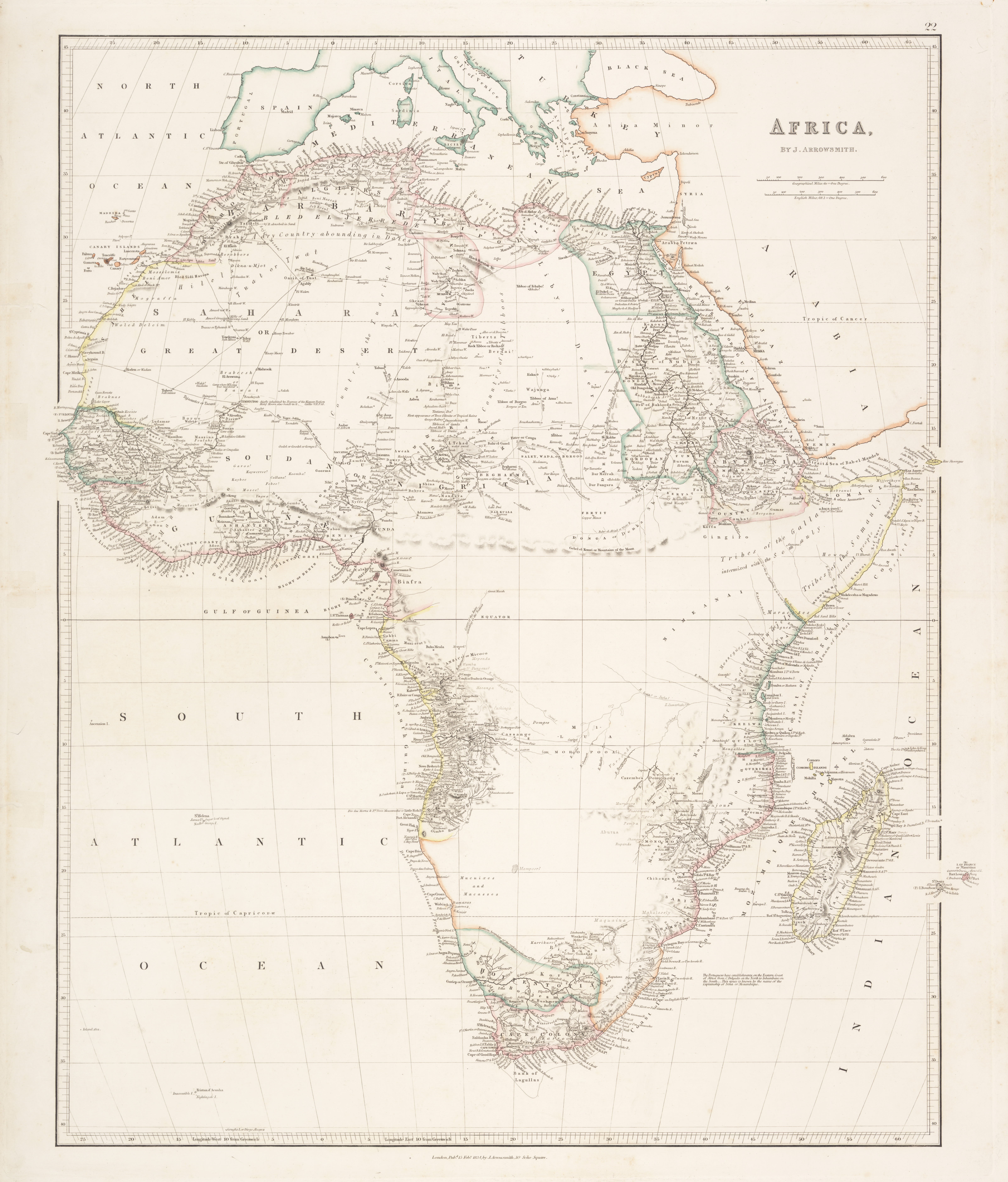
Pubd. Feby. 15, 1834, by J. Arrowsmith, 35 Essex Street Strand. Hand colored in outline. Relief shown by hachures. Prime meridian: Greenwich. From [London atlas of universal geography]. London: J. Arrowsmith, [1837], plate 22.
Creator:
Arrowsmith, John, 1790-1873
Provider:
Michigan State University
Resource Class:
Maps
Temporal Coverage:
1834
Spatial Coverage:
Africa
Access Rights:
Public
Format:
JPEG
More details at:
https://lib.msu.edu/branches/map/MSU-Scanned/Africa/300-A-1834/
Tools
Cite
Download
Original
Jpeg